 (Image via
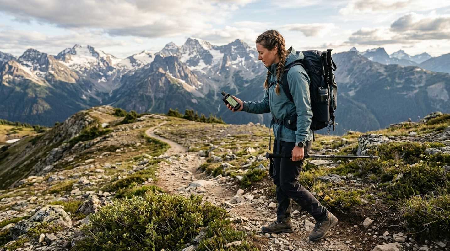
Heading into the backcountry offers a profound sense of freedom, but it also removes the safety net of modern civilization. In the wilderness, the weather is not just a topic for small talk; it is a critical variable that dictates your safety, your route, and sometimes your survival. A bluebird sky can transform into a life-threatening blizzard or a flash flood in a matter of hours. While learning to read clouds and barometric pressure is a valuable skill, modern technology provides a layer of foresight that was unimaginable a few decades ago. Real-time weather trackers serve as your digital lookout, offering precise data that helps you make informed decisions before you get caught in the storm.
Equipping yourself with the right digital tools transforms your smartphone from a passive device into a powerful meteorological station. These applications do more than just tell you the temperature; they visualize wind patterns, track precipitation cells with radar precision, and provide localized alerts for specific mountain peaks or valleys. Whether you are planning a multi-day backpacking trip through the Rockies or a quick trail run in your local state park, having access to accurate, up-to-the-minute weather data is as essential as carrying a first aid kit. This guide explores the most reliable weather tracking tools designed to keep backcountry adventurers safe and prepared for whatever nature throws their way.
Visualizing the Atmosphere with Windy
Windy has rapidly become a favorite among pilots, sailors, and serious outdoor enthusiasts because it offers an unparalleled visual representation of global weather patterns. Unlike standard apps that just give you a static icon of a sun or cloud, Windy provides an interactive, animated map that shows you exactly what the atmosphere is doing in real-time. You can toggle between different forecast models, such as the European ECMWF, the American GFS, and local NEMS models, allowing you to compare predictions and spot potential discrepancies. This level of detail is crucial for backcountry travelers who need to understand not just if it will rain, but from which direction the wind is blowing and how weather systems are moving across complex terrain.
The app excels in its versatility, offering dozens of different layers that go far beyond basic precipitation. You can visualize wind gusts, cloud base heights, freezing altitudes, and even thunderstorm energy (CAPE). For a hiker attempting a high-altitude summit, knowing the wind speed at different elevations can be the difference between a successful climb and a dangerous situation. While Windy does require a data connection to update the models, its comprehensive caching features allow you to check the latest animation before you lose signal, giving you a mental map of how the weather is expected to evolve over the next few hours. It turns complex meteorological data into an intuitive visual language that anyone can understand.
Pinpointing Mountain Conditions using OpenSummit
General weather apps often fail in the mountains because they pull data from the nearest town or airport, which might be thousands of feet lower in elevation than your campsite. OpenSummit was built specifically to solve this problem, using proprietary technology to adjust forecasts for precise locations on specific peaks and trails. It takes into account how topography influences weather, providing hourly breakdowns of temperature, wind chill, chance of precipitation, and lightning potential for thousands of hiking and skiing destinations. This hyper-local accuracy is invaluable for mountaineers and backpackers who need to know if a storm will hit the ridge at noon or if the cloud cover will lift by sunset.
One of the standout features of OpenSummit is its ability to quantify trail conditions based on recent weather history. It can estimate if the ground will be muddy, snow-packed, or dry, helping you choose the right footwear and gear before you even leave the house. The premium version offers even more granular data, including estimated snow accumulation and long-range trends that help with trip planning weeks in advance. By focusing exclusively on the unique microclimates found in high-altitude environments, OpenSummit provides a level of confidence that generic weather aggregators simply cannot match. It essentially puts a mountain meteorologist in your pocket, ready to advise you on the specific challenges of your chosen route.
Tracking Storms like a Pro with RadarScope
For those who want to see exactly what a storm cell is doing without any filtering or smoothing, RadarScope is the professional standard. While many apps smooth out radar images to make them look pretty, RadarScope provides raw, Level 3 NEXRAD radar data directly from the National Weather Service. This allows savvy users to see the intensity of precipitation with incredibly high resolution, identify hail cores, and even detect the rotation in a storm that could indicate a tornado. For backcountry travelers in areas prone to severe afternoon thunderstorms, such as the Colorado Rockies or the Sierra Nevada, this tool offers the fastest, most detailed look at approaching danger.
The interface is admittedly more technical than your average weather app, but the learning curve is worth it for the safety benefits. You can tap on individual radar stations to get the clearest view of your specific area, minimizing the blockage from terrain that can obscure weather in mountainous regions. The app also features strict severe weather warnings, drawing polygons on the map to show exactly which areas are under a warning or watch. When you are exposed on a ridge line or setting up a tent in a valley, knowing the precise velocity and direction of an incoming storm cell allows you to make split-second decisions about whether to hunker down or make a run for lower elevation.
Staying Alert with MyRadar Weather Radar
MyRadar strikes a perfect balance between professional-grade data and user-friendly accessibility, making it one of the fastest apps for checking conditions on the fly. As soon as you open the app, it presents a high-definition radar loop that loads almost instantly, showing you where precipitation is relative to your current location. Its strength lies in its fluid animations and predictive capabilities; the app projects the path of rain or snow up to an hour in advance, giving you a reliable "heads up" on when the skies are about to open up. This immediate visual feedback is perfect for hikers who need a quick check during a water break without fumbling through endless menus.
Beyond the radar, MyRadar offers an impressive suite of aviation and wildfire layers that are particularly useful for backcountry exploration. The wildfire layer tracks active fires and smoke plumes, which is critical information during the dry summer months in the western United States. Additionally, the app can send push notifications for approaching rain based on your GPS location, acting as an automated sentry that alerts you to changes even when your phone is in your pack. While it relies on cellular data, its efficiency in loading data packets makes it usable even in areas with spotty, weak reception where other data-heavy apps might fail to load.
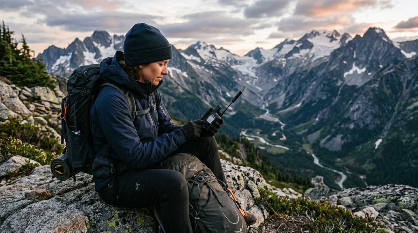
Securing Off Grid Forecasts via Garmin inReach
Real-time tracking apps are fantastic, but they all share one fatal flaw: they require a cellular connection. In the deep backcountry, where service is non-existent, the Garmin inReach series becomes the ultimate weather tool. While primarily a satellite communicator for SOS and messaging, the inReach device can request and receive detailed weather forecasts directly via the Iridium satellite network. This means you can get up-to-date reports on temperature, precipitation, and wind for your exact GPS coordinates, no matter how far you are from the nearest cell tower. It bridges the gap between civilization and the wilderness, ensuring you are never truly flying blind.
The tracking capabilities of the inReach work in reverse as well, allowing loved ones at home to track your progress and send you weather updates from their end if they see a major system developing on the news. The device offers basic and premium weather packages, with the latter providing high-detail forecasts similar to what you would see on a smartphone app. For multi-day expeditions or thru-hikes where conditions can shift drastically over the course of a week, having the ability to pull a fresh forecast from space is a game-changer. It provides the peace of mind that comes with knowing you can adapt your plans based on current data, rather than relying on a stale forecast you read three days ago at the trailhead.